


Encom Discover PA 2013 Windows
Encom Discover is the desktop Geographical Information System (GIS) designed especially for geosciences, providing the tools to effectively compile, visualize, analyze, and map spatial geoscience data.
Since its release in 1994, Discover with MapInfo Professional has become the GIS of choice for geologists, environmental scientists, cartographers, exploration managers, and database administrators.
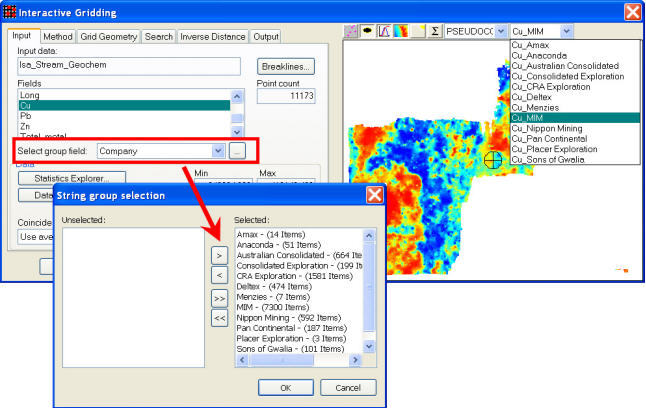
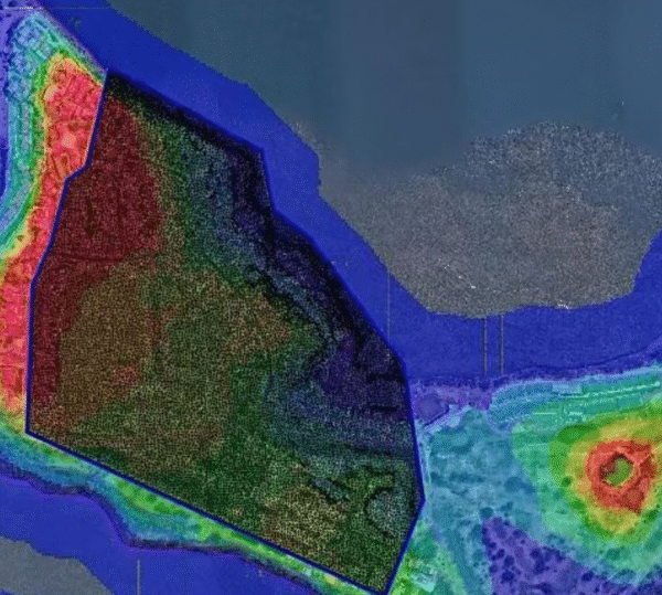
Build geological datasets, produce high-quality scaled geological maps, with title blocks, map grids, legends, structural symbols, etc; compile drill hole data and create cross-sections, plans, and logs; create, filter, contour, profile, manipulate, color, and analyze gridded surfaces; analyze and visualize geochemical data; rectify unprojected raster images; create graphs with maintained spatial links for interactive analysis; enhance your GIS productivity via an extensive range of data, object, table and map windows utilities and many others.


Reviews
There are no reviews yet.