


Trimble Terramodel 10.61 Windows
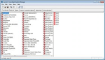
The Trimble Terramodel™ software is a powerful software package for the Surveyor, Civil Engineer, and Contractor, who requires a CAD and Design package with integrated support for raw survey data. Using Terramodel software you can import data collected using the Trimble conventional instrument product line, as well as from the Trimble TSCe™ Controller running the Trimble Survey Controller™ software. The software allows you to do all the necessary COGO calculations, quickly and easily produce roadway designs, generate contours, and calculate volumes.
With the integrated 3D Visualizer, you can view your project as an interactive 3D model, which makes the design and quality control process extremely efficient. With the powerful CAD functions available, you can perform survey, engineering, and CAD tasks all in one package! With the convenience of several modules, Terramodel software can be configured to provide the features needed.
Additionally, road data can be exported from Terramodel software to the RoadLink module of the Trimble Geomatics Office software using the TRMBROAD macro. Terramodel macros (TML) for these features are included on the Trimble Geomatics Office v1.6 CD. DTM data can be shared using a 3D faces file.
The Terramodel software is ideal for surveyors who require an integrated Survey, CAD, drafting, and surface modeling tool.


Reviews
There are no reviews yet.